Enrique Adolfo Jiménez Airport
| Kaupunki: | Colón |
| Maa: | Panama  |
| IATA-koodi: | ONX |
| ICAO-koodi: | MPEJ |
| Koordinaatit: | 9°21′23″N, 79°52′2″W |
| Kiitotiet: |
Suunta: 18/36, Pituus: 1829 x 46 m, korkeus: 7 m |
Sijainti karttalla
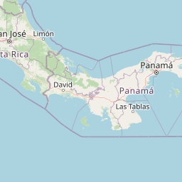


Leaflet | © OpenStreetMap contributors