Higuerote Airport
| Kaupunki: | Higuerote |
| Maa: | Venezuela  |
| IATA-koodi: | HGE |
| ICAO-koodi: | SVHG |
| Koordinaatit: | 10°27′44″N, 66°5′34″W |
| Kiitotiet: |
Suunta: 08/26, Pituus: 1200 x 30 m, korkeus: 3 m |
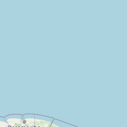
Sijainti karttalla
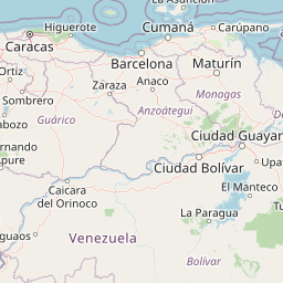

Leaflet | © OpenStreetMap contributors
| Kaupunki: | Higuerote |
| Maa: | Venezuela |
| IATA-koodi: | HGE |
| ICAO-koodi: | SVHG |
| Koordinaatit: | 10°27′44″N, 66°5′34″W |
| Kiitotiet: |
Suunta: 08/26, Pituus: 1200 x 30 m, korkeus: 3 m |